
Current Projects

Past Projects


-

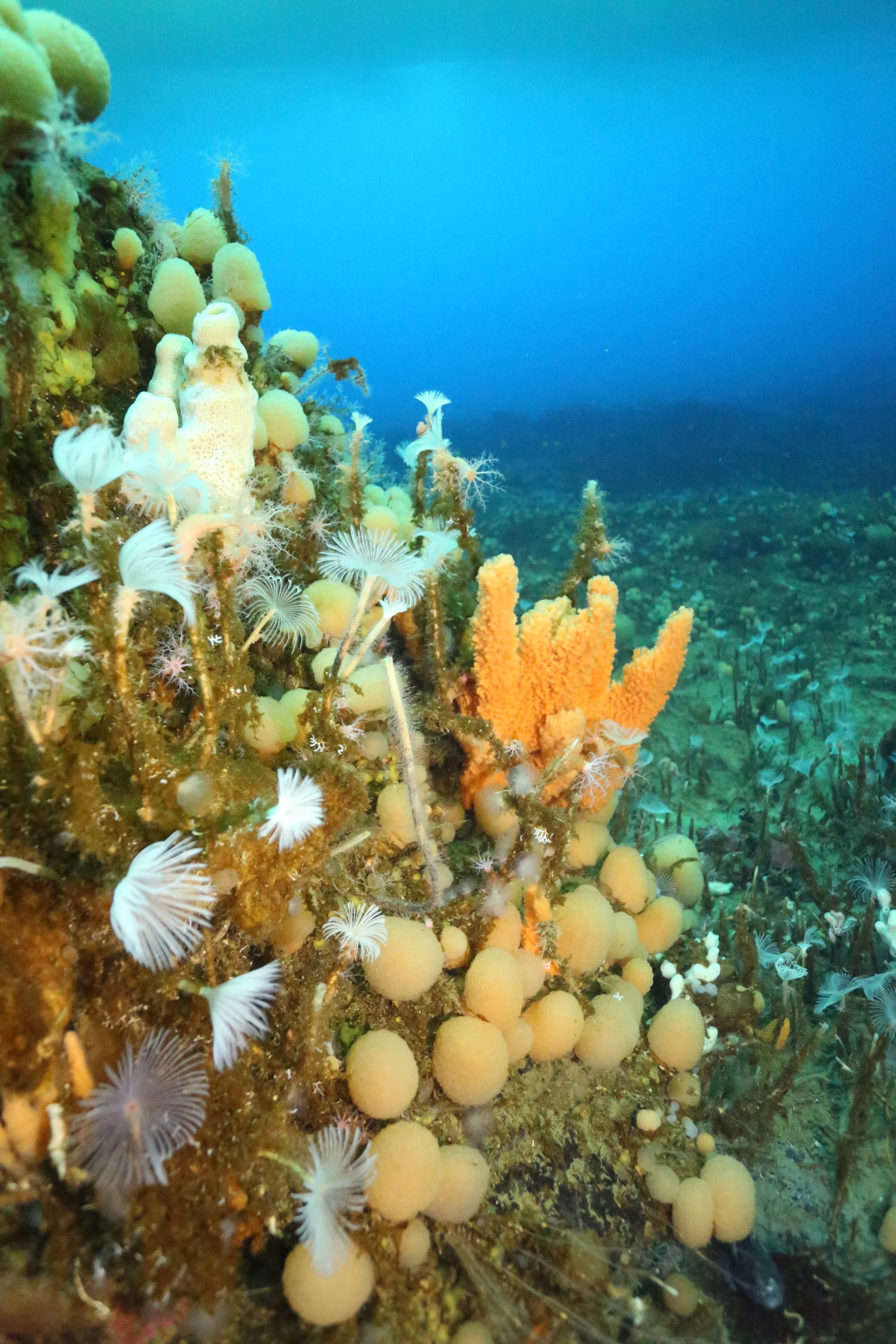
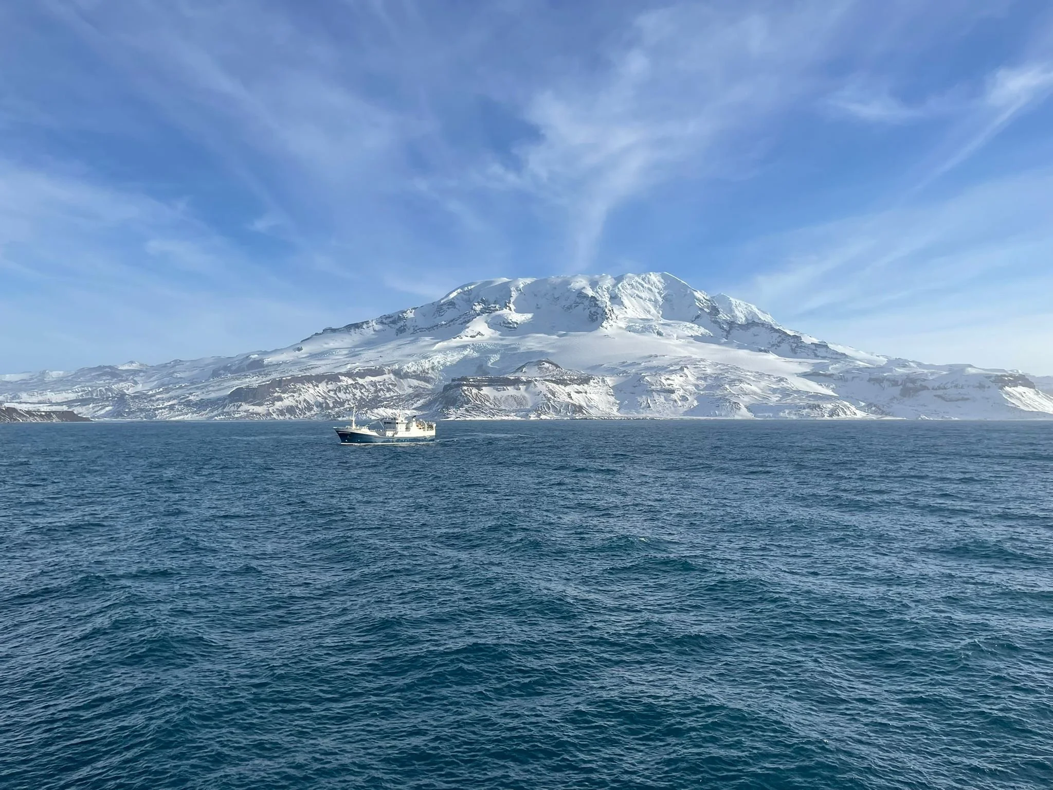
Getting to the bottom of it: Mapping baselines and observing trends of Antarctic seafloor biodiversity
Jan Jansen
Rapid declining marine biodiversity threatens the functioning and stability of ecosystems worldwide. The highly diverse Antarctic seafloor communities provide many critical ecosystem services, including for commercially important fish species and as a resource for pharmaceutical compounds. The conservation value of Antarctic seafloor biodiversity is therefore well recognised in science and policy. However, key aspects of the Antarctic seafloor ecosystem and how they respond to a rapidly changing environment remain poorly understood because of lacking data. This DECRA combines biodiversity mapping, seafloor images and artificial intelligence with the development of the world’s first submersible-based monitoring project to fill crucial knowledge gaps that currently hinder informed management of one of the most unique and pristine ecosystems on Earth. Maps of the distribution of shallow/coastal Antarctic seafloor biodiversity will aid Australia’s efforts to establish Marine Protected Areas in the waters adjacent to its Antarctic claim. Low-cost seafloor images, collected from tourist submersibles, will be of unmatched value for monitoring and will complement data collected during expensive research cruises. Automatically extracted biodiversity information from images will be rapidly reported to policy makers, allowing Australia and the international community to better manage and conserve the unique Antarctic marine ecosystem.
Funded by: Australian Research Council - DECRA ($488,691)
Contact: jan.jansen@utas.edu.au
-
Assessing the effects of climate change and marine heatwaves on deep reef ecosystems across the Temperate East Marine Parks Network for improved management
Joel Williams, Moninya Roughan (UNSW), Tim Ingleton (NSW DCCEEW)
Students: Steph Woolley (PhD)
In Australia, marine heatwaves are increasing in frequency and severity and are costing the Australian economy and environment through fisheries closures and biodiversity loss. Most concerningly, current forecasts for the upcoming 12-month period suggest that the east coast of Australia will experience the worst marine heatwaves and warmest ocean water ever recorded. Recent research has demonstrated the marine heatwaves are having large impacts at depth. The impact of marine heatwaves on deeper shelf rocky reefs, also known as mesophotic and rariphotic reefs is virtually unknown. Mesophotic reefs are seabed habitats between the depths of 30m to 150m and are characterised by mid-light conditions, whereas rariphotic reefs extend from 150m to 300m and are characterised by low to no light conditions. These complex and newly described ecosystems are beyond scuba diving depths and are therefore vastly understudied and support highly productive habitats and diverse fish assemblages, including threatened and protected species. Marine heatwaves are likely to results in sponge bleaching, change in habitat structure, range extension of species, and increased pressures on threatened species such as Black Rockcod and the Grey Nurse Shark. The Temperate East Network of Marine Parks were designed to protect representative examples of a regions ecosystems and biodiversity. This project aims to understand how marine heatwaves will impact mesophotic and rariphotic reefs within the Temperate East Marine Park Network. This will be achieved by training Sea Ranger and the community in collecting water temperature profiles to monitor water temperature inside each marine park. We will also be collecting baseline data on habitat and fish assemblages. This information will be used to inform the review of the Temperate East Marine Park Network Management Plan.
Funded by: Department of Climate Change, Energy, the Environment and Water - Our Marine Parks Grant ($489,465)
Contact: joel.williams@utas.edu.au
Developing a cost-effective and novel fisheries-independent monitoring program to inform scalefish fisheries management
Alyssa Marshell, Nils Krueck, Joel Williams, Sean Tracey, Neville Barrett, Nick Perkins, Chris Brown
Students: Louis Kingston
Target species of Tasmanian scalefish fisheries (TSF) remain difficult to assess and manage due to the wide range of species and variety of both commercial and recreational fisheries methods. TSF are currently assessed using commercial catch and effort data as well as age and length information. However, some key TSF species landings are increasingly greater in the recreational sector, with a comparatively low commercial catch. Therefore, due to the absence of regular and robust CPUE data, innovative fishery independent data collection programs are required to routinely monitor TSF species and provide adequate data for stock assessment models. This project will review and collate data from previous studies to design and test strategic and cost-effective novel fishery-independent survey methods that collect population dynamics data for a suite of key scalefish fisheries species, across both environmental and fishing intensity gradients in Tasmania. Outcomes will improve stock assessment methods by providing new and additional data for data-poor and undefined species, and, if proven cost-effective, establish an ongoing, long-term fishery-independent monitoring program to enhance the sustainability of TSF. Informing data-poor stock novel assessment approaches will have implications for fisheries managers making critical management decisions for depleted, depleting, and undefined TSF species.
Funded by: Fisheries Research & Development Corporation Grant ($370,386)
-
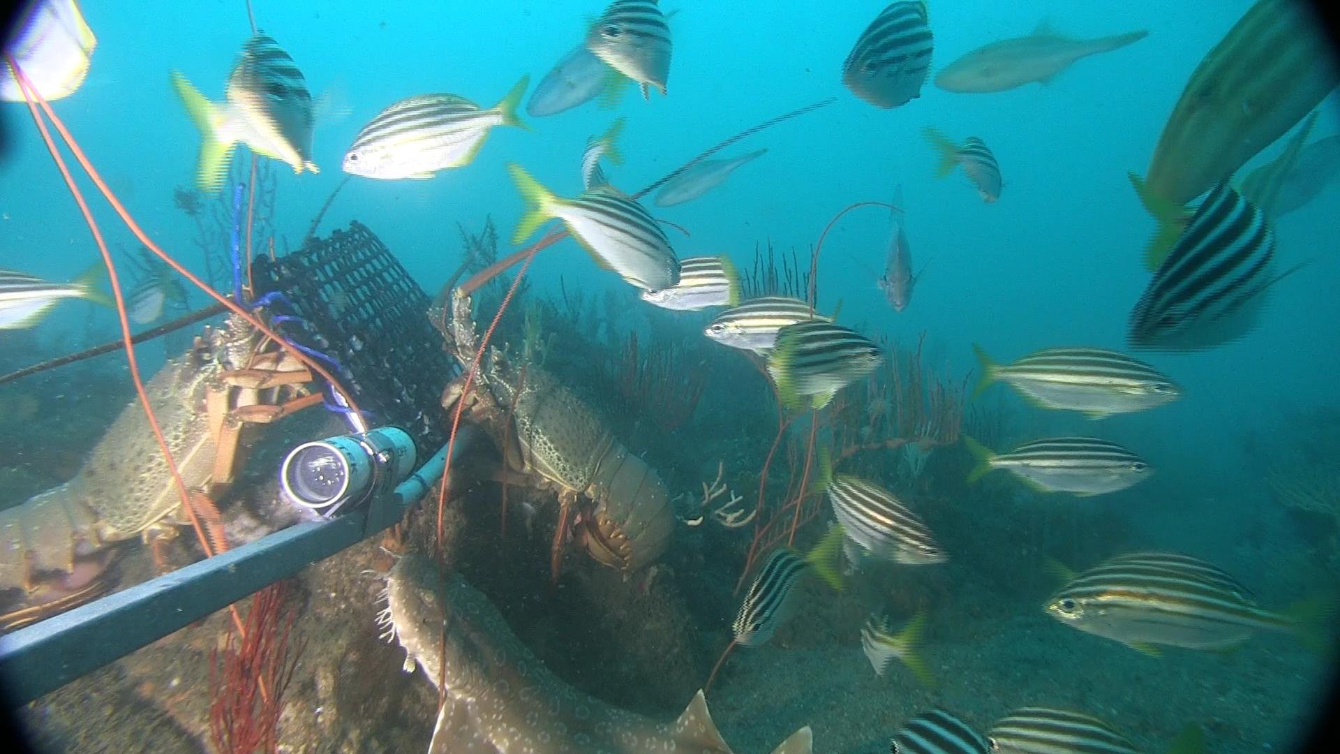
Habitat ecological risk assessment for eco-regions with high trawl footprints, in southern Queensland and northern NSW
Rodrigo H. Bustamante (CSIRO), Tony Courtney (QDAF), Joel Williams
Map the distribution and abundance of habitat and bycatch species in southern Queensland and northern NSW, with a focus on trawl-exposed eco-region. Complete a quantitative risk assessment for seabed habitats and bycatch species. Then, use an objective management evaluation strategy type approach, if required, to evaluate any risk-management option proposed for sensitive habitats and bycatch species.
Funded by: Fisheries Research & Development Corporation Grant ($2,156,521)
Contact:
Development of regional modelling and risk assessments to inform offshore renewable decision-making
Keith Hayes (CSIRO), Joel Williams, Myriam Lacharite
Australia is entering a phase of rapid offshore renewable energy (ORE) development, with several regions earmarked for wind farms on the eastern and south-eastern coasts. In considering the environmental acceptability of wind energy projects, the Department of Climate Change, Energy, the Environment and Water (DCCEEW) will assess potential risks to (among other things) the recovery of populations listed under the Environment Protection and Biodiversity Conservation Act (EPBC Act 1999). The assessment process will consider cumulative environmental impacts at a regional or even ocean basin-scale, in addition to environmental factors specific to ORE. Additionally, the National Offshore Petroleum Safety and Environment Authority (NOPSEMA) has identified the need for improved understanding on species, processes and industry activities to support impact and risk assessment.
This project will demonstrate the use of two kinds of modelling (whole-of-ecosystem modelling and individual species modelling) to estimate the impacts and risks of installing ORE infrastructure in the Gippsland declared region. The project will use the Impact pathways defined by DCCEEW to structure its approach and methods, and will work with DCCEEW and NOPSEMA to identify priority species and associated data needs.
Funding: NESP Marine and Coastal Hub ($1,749,674)
Past Projects
-
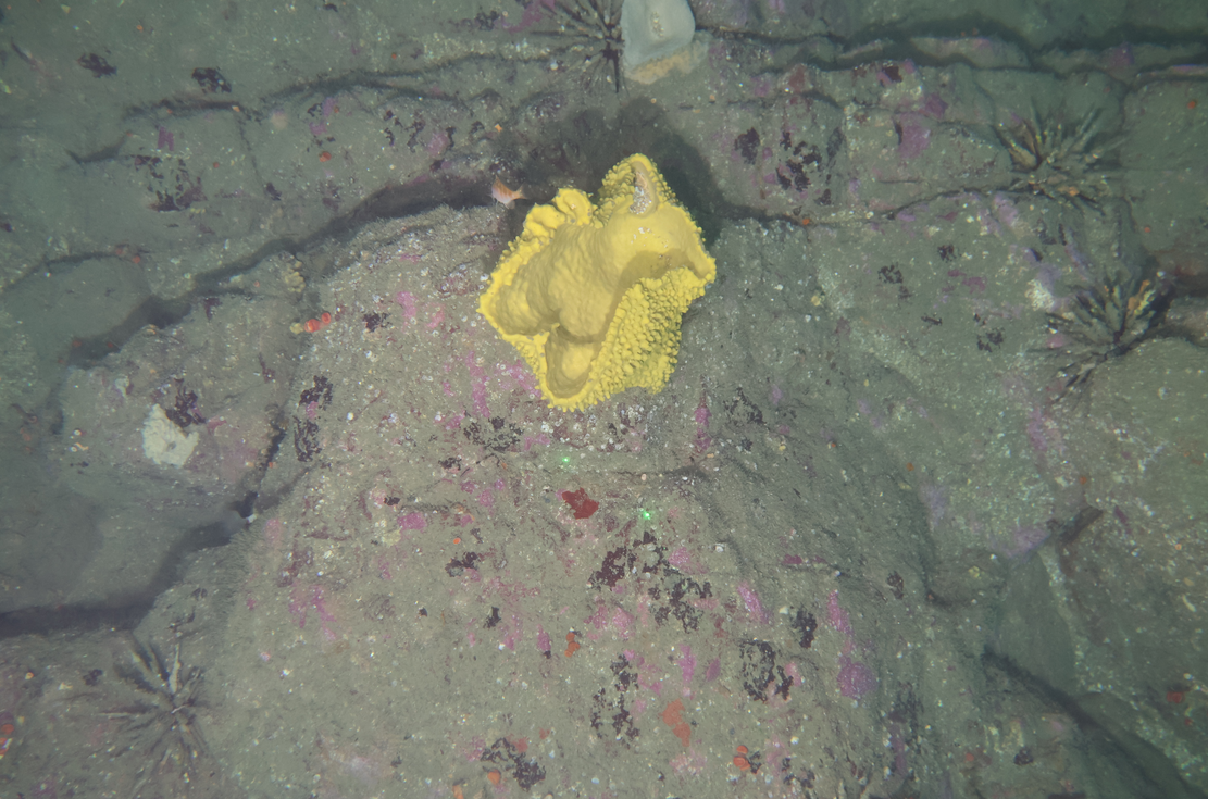
Predicting biodiversity distribution on the Antarctic continental shelf
Craig Johnson, Nicole Hill, David Barnes, Ben Galton-Fenzi
Post-doc: Jan Jansen
Students: Charley Gros
Antarctic seafloor communities are unique and highly diverse, but their distribution is poorly known because biological data are sparse. We aim to develop an international database of underwater observations to, for the first time, predict the distribution of seafloor biodiversity over the entire Antarctic continental shelf for the present day and 2100. These predictions depend on a unique and validated approach to estimate the present and future redistribution of surface primary production to the seafloor, and will enable calculating the amount of atmospheric carbon captured and stored at the seafloor. The maps will be at an unprecedented resolution (~2 km), and be invaluable tools underpinning policy, management and future science.
Funded by: Australian Research Council Grant-Discovery Projects ($660,000)
Contact:
Media
The Conversation: Antarctic seas host a surprising mix of lifeforms – and now we can map them
-
Detecting, attributing, predicting and monitoring ecological change in the Southern Ocean
Craig Johnson, Nicole Hill, Kerrie Swadling
Post doc: Joel Williams
Students: Yash Gimonkar (PhD), Rebecca Konijnenberg (PhD), Tom Bleach (Masters)
This project aims to provide scientific information on the ecological impacts of climate change and other drivers on key components of the Southern Ocean ecosystem to facilitate evidence-based monitoring, management and policy decisions. we will use new statistical methods in ecology and combine them with existing, long-term datasets of demersal fish on the Kerguelen Plateau and zooplankton in East Antarctica. We will provide maps and new, quantitative knowledge on if, how (which species) and why (in response to which factors) these key Southern Ocean assemblages have changed in recent years and what they are likely to look like in the future. This will significantly advance the scientific information available for planning and evaluation policy and management actions. it will also provide a basis for optimising the design of an effective and cost-effective zooplankton monitoring system to track changes and measure the performance of spatial management into the future.
Funded by: Department of Climate Change, Environment, Energy, and Water (Cwth) Grant-Australian Antarctic Science ($511,552)
Contact:
References:
Media:
The Conversation: Fish species off icy Heard Island bounced back when illegal fishing stopped and sustainable fishing continued
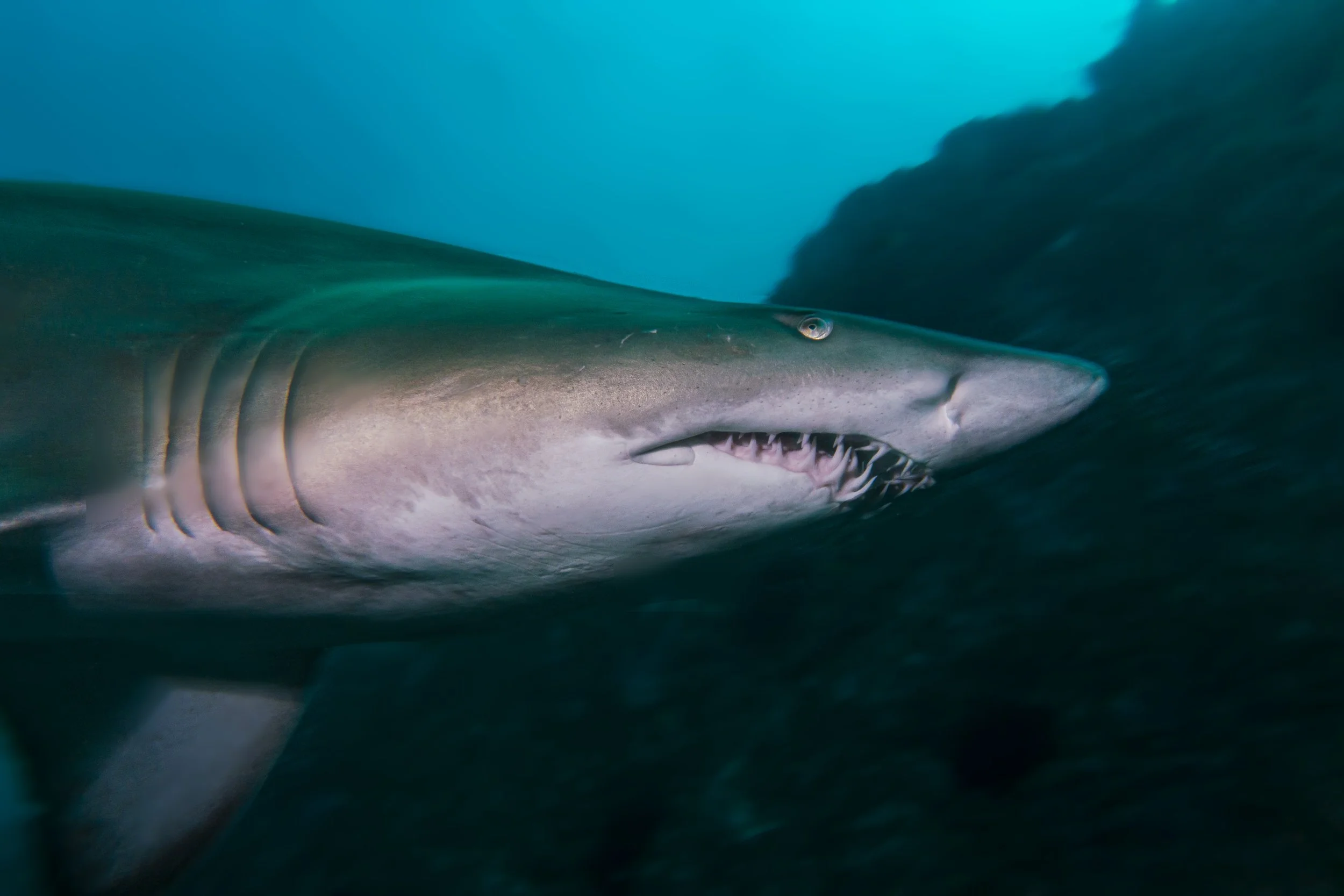
NESP Marine and Coastal Hub Project 4.15: Grey Nurse Shark Aggregations
Russ Bradford, Joel Williams, Emma Westlake, David Harasti
The grey nurse shark (Carcharias taurus) has been protected in Australian Commonwealth waters since 1996 (DoE, 2014). Although historically distributed across southern Australia (Last and Stevens, 2009), in October 2001 the grey nurse shark was listed as two separate populations with different protection listings under the EPBC Act of 1999: Critically Endangered in eastern Australia, and Vulnerable in Western Australia (DoE, 2014). Grey nurse sharks (GNS) tend to aggregate at specific sites along migration routes. There are currently 19 identified key aggregation sites along the eastern seaboard. A key aggregation site is defined as a site consistently occupied by five or more GNS throughout the year (Otway et al. 2003). Recent observations indicate that this definition requires revision to account for factors such as seasonal movements and to be applicable to the Western Australian population. This project aims to collate existing information on key aggregation sites and new sites where GNS have been found to gather (both in eastern and western Australia). This information will be used to refine the definition of key aggregation site and develop criteria to allow assessment of new sites at a separate workshop to be held by DCCEEW. This project will also investigate potential sites in Victoria where the least amount of information is available.
Funded by: Department of Climate Change, Energy, the Environment and Water
Final Report: COMING SOON!